We are pleased to announce that dymaptic, an Esri Gold Partner, has been awarded the Esri State and Local Government Specialty. Esri’s speci...
.jpg?width=596&height=447&name=IMG_0109%20(1).jpg)
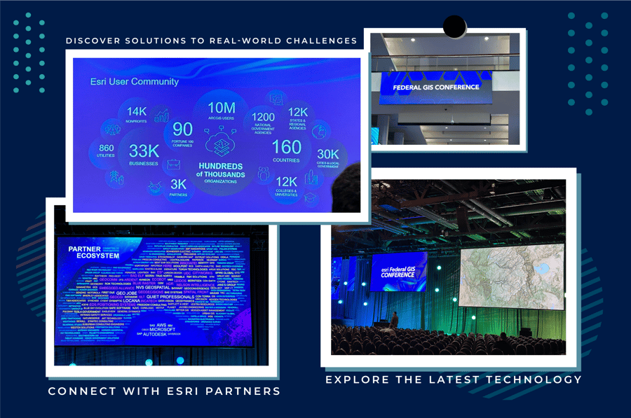
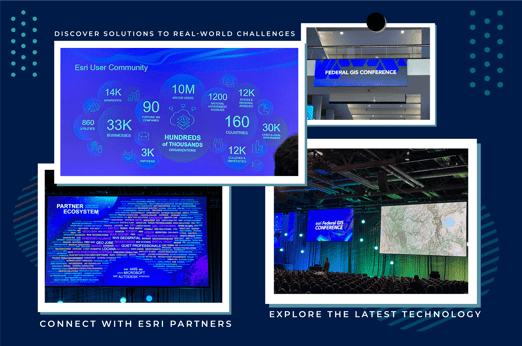
A few weeks ago, I attended my first Esri Federal GIS Conference. It was an exciting time to be there, to learn new things, and to network with Esri staff, Esri Partners, and organizations that use GIS – approximately 6,000 attendees in all. This conference is distinctly tailored to address the needs of Esri's federal clients and the partners supporting federal agencies.
Dymaptic, an SBA-certified Economically Disadvantaged Women-Owned Small Business (EDWOSB) is not new to government work. Our team has experience working on projects for city, state, and federal clients. We take pride in helping our government clients implement solutions to address complex geospatial issues and optimize their workflows. We recently earned the Esri Federal Small Business Specialty, which recognizes small businesses that are prepared to develop ArcGIS software-based offerings for federal government clients. With this new credential in hand, myself and dymaptic CEO Mara Stoica headed off to Washington, D.C.
My career experience includes working for federal agencies, including the U.S. Geological Survey and USDA-NRCS, so I am definitely aware of how long things can take for government procurement. The process isn't one of meeting with government organizations or even large government contractors and hoping to get a contract. It takes time to build rapport with the staff, either with the federal agency or with the large government contractors, in hope that your small business can help field a need that they might have. We made some great connections with large government contractors who could use our unique skillset as an EDWOSB GIS service provider and software development company.
After returning home from the conference and reviewing my notes, here are my key takeaways from the event:
Generative AI – Esri shared how they are incorporating generative AI into their technologies. They shared a few examples, such as using AI to help with search capabilities in ArcGIS Hub and to help develop collection forms in Survey123. They are continuing to develop AI capabilities within Esri tools, so I’m sure there will be more to come!
ArcGIS Pro – and migrating from ArcMap – We all know that ArcMap goes into mature support starting in March 2024. Esri highlighted that ArcGIS Pro has more functionality than ArcMap, so if loss of functionality has been keeping you from migrating, it might be time to start moving. (Need help? Dymaptic can assist you with the migration process and ensure your custom ArcMap Add-Ins transition over to ArcGIS Pro!)
Living Atlas – Esri’s Living Atlas includes curated, authoritative spatial data layers that can be used by GIS professionals in either ArcGIS Pro or ArcGIS Online, or with ArcGIS Enterprise. Within Living Atlas, nearly 100 key data sets from the National Geospatial Data Assets (NGDA) are available, including information on roads, watersheds, and census data.
Here are a few highlights of Living Atlas that were presented to the crowd:
- Living Atlas layers can be deployed behind a firewall if using ArcGIS Enterprise.
- The presenter showed how to leverage Living Atlas layers in a workflow. The user can define Arcade expressions from multiple Living Atlas layers without downloading layers.
- Coming soon! Later this year, iNaturalist will be available – a biodiversity layer that contains crowdsourcing data, including millions of records for millions of species, that can be used for analysis.
I was really interested in a demonstration on using Living Atlas layers with tools in ArcGIS Online for cartographic analysis. The Esri team used two layers – one showing census tracts eligible for broadband funding and another showing population footprints. By using the blend tool in ArcGIS Online, they were able to create a better cartographic representation of the data by showing the underserved and unserved areas using the footprint layer, instead of the entire administrative boundary. This made it possible to see where the populations underserved by broadband live – information that could be used to make decisions on funding and services.
 And, a bonus takeaway: I was surprised by the number of nonprofit organizations who attended the conference. There were many nonprofits based in and around DC that took advantage of this opportunity to connect with Esri and other Esri users. At dymaptic, we hold the Esri Nonprofit Specialty and have long-standing relationships with multiple nonprofit clients. For us, this presented an opportune moment to engage with the Esri Nonprofit team and connect with other nonprofit organizations.
Overall, for Dymaptic and myself, I felt this conference was especially beneficial for networking and building new and curating existing relationships. I am thankful for the opportunity to attend and looking forward to building on the connections that I made and returning next year.
If you’d like to hear more highlights from the conference, check out the Esri Federal GIS Conference Plenary.
If you’d like to connect with dymaptic on government contracting, migrating to ArcGIS Pro, or any other GIS needs, let’s talk!
Related articles


Fall conference season is upon us, and today we’re highlighting the dymaptic team attending the Kentucky Association of Mapping Professional...

As any CGP Grey fan knows, hexagons are indeed the bestagons. But here at dymaptic, we're not just on the hexagon bandwagon because they loo...