As any CGP Grey fan knows, hexagons are indeed the bestagons. But here at dymaptic, we're not just on the hexagon bandwagon because they loo...

ChatGPT has been the talk of the town recently. OpenAI launched the chatbot in research preview last month and is making it free to use during this time. We do not know how long this free preview will last but we highly encourage everyone to check it out. It is one cool tool
What is ChatGPT?
Who better to answer this question than ChatGPT itself. We asked it to write a short description of what ChatGPT is and this was its response:
ChatGPT is a chatbot trained on a large corpus of text data using the GPT-3 language model developed by OpenAI. It is capable of generating human-like responses to user input, allowing for conversation on a wide range of topics. ChatGPT is designed to be a helpful tool for users looking to have a natural language conversation with a virtual assistant.
But can ChatGPT do GIS? Here are 5 ways we came up with that ChatGPT can help you in your everyday GIS work.
1. Use ChatGPT to help you decide what tool to use
The GIS world is vast and the Esri ecosystem itself has too many tools to keep track of. So when you have a task to perform and you’re not sure what tool would be best to use, ask ChatGPT. For example, you can ask it something very generic like “How do I store spatial data?”. Or you can be platform specific and ask “What Esri tool should I use to create web maps?”
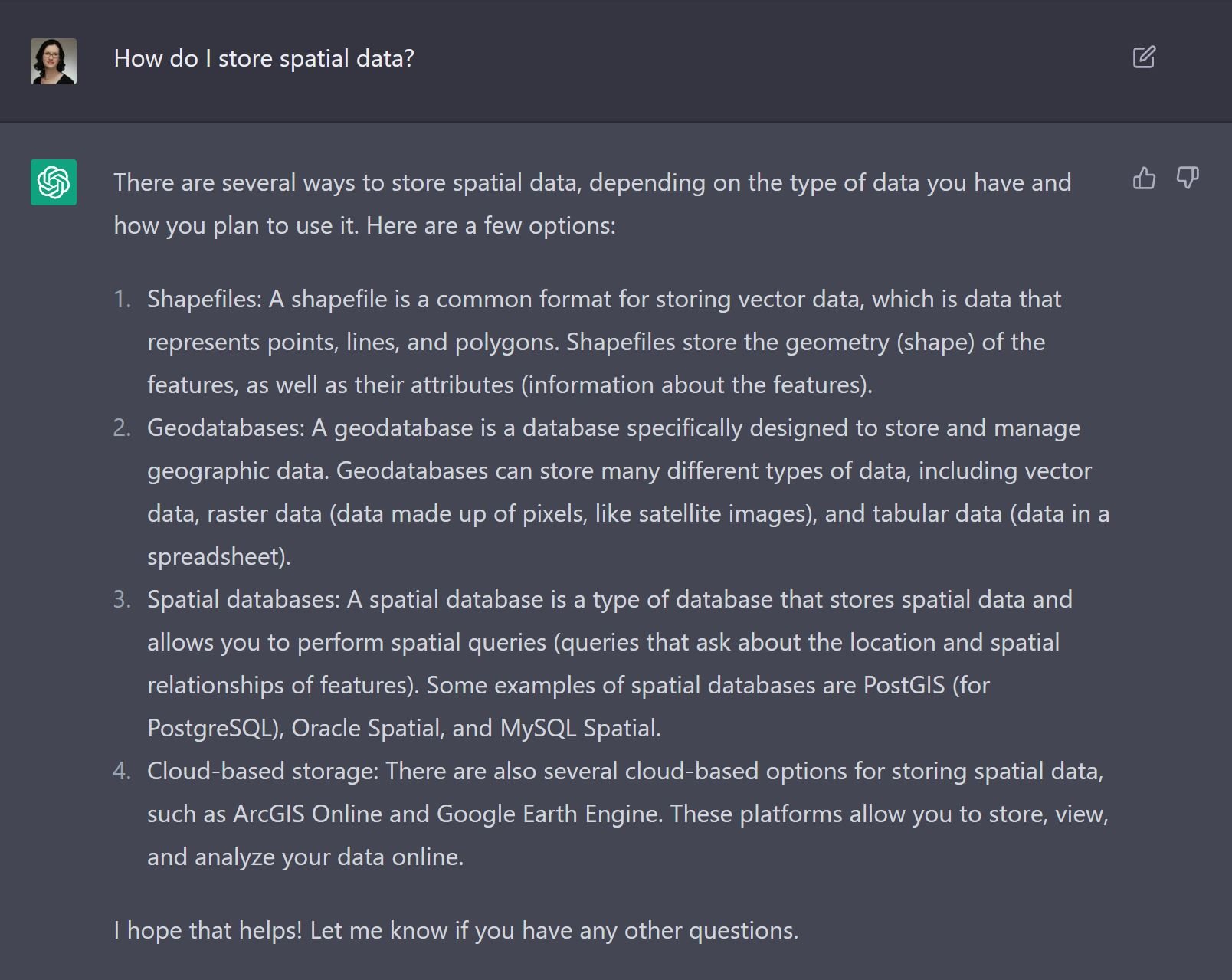
Keep in mind though that the answers you receive are not necessarily the best option so use them as suggestions or inspiration and do your research before proceeding with actual work.
2. Ask it for help with your favorite GIS app
Let’s be honest here. Reading documentation is kind of a pain. First, you have to find it. Then, you have to figure out where in the mountain of documents is the bit you’re looking for. And finally, you have to read through it. And sometimes it’s too verbose, and other times it’s not clear enough.
So, instead, ask ChatGPT to tell you how to use a specific feature of a specific app. For example, “How do I select features in ArcGIS Pro?” results in a short paragraph that describes where the Select tool lives and how it works, but also a list of suggestions of other types of selections you can perform, like Select by Attributes or Select by Location. Very helpful!
3. Employ ChatGPT to compare GIS apps
There are a lot of tools in GIS that do more or less the same task, but yet they’re different. Don’t know what the difference is between ArcGIS Velocity and GeoEvent Server? That’s OK. Use ChatGPT to compare them and decide which of the two is right for you.
ArcGIS Velocity and GeoEvent Server are both tools for working with real-time data in a GIS context, but they have some key differences in terms of their capabilities and intended uses.
ArcGIS Velocity is a new feature in the ArcGIS platform that allows users to quickly and easily ingest, process, and visualize real-time data streams. It is designed to be easy to use and accessible to a wide range of users, including non-technical users who may not have experience with GIS or real-time data analysis.
GeoEvent Server, on the other hand, is a more advanced and customizable tool for working with real-time data. It is part of the ArcGIS Enterprise platform, and it allows users to create custom real-time data processing pipelines, using a range of pre-built and custom connectors to integrate with a variety of data sources and systems.
Overall, ArcGIS Velocity is a more user-friendly and simplified tool for working with real-time data, while GeoEvent Server offers more advanced and customizable capabilities for working with real-time data streams. The best tool for you will depend on your specific needs and requirements.
4. Let it write basic code for you
Yes, ChatGPT can also write code for you. And it even knows about things like ArcPy. We asked it to “create an arcpy script that loops through a feature class and returns all features that have State = NM”. Here’s the result, complete with comments!
# Import the necessary ArcPy module
import arcpy
# Set the path to the feature class to be queried
fc = r"C:\path\to\feature\class.shp"
# Create a search cursor to loop through the features in the feature class
with arcpy.da.SearchCursor(fc, ["State"]) as cursor:
# Loop through the features and print the values of the "State" field
for row in cursor:
if row[0] == "NM":
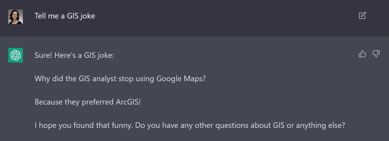
print(row[0])5. Lighten up your day with GIS jokes
Turns out that ChatGPT has a sense of humor … sort of. It’s a bit dry at times, but every so often it generates a winner like this one.
6. Use ChatGPT to explain what you do to non-GIS family and friends
Oh, the dreaded “What do you do?” question. In my world, it goes something like this:
New acquaintance: What do you do?
Me: I make software. I’m a programmer.
New acquaintance: What kind of software?
Me: GIS Software
New acquaintance: Huh? (while raising an eyebrow)
Me: It’s mapping software. Kinda like Google Maps but on steroids.
New acquaintance: Oh cool! (walks away having no idea what I was talking about)
So I asked ChatGPT to explain GIS to me like I was 5. The answer will definitely confuse a 5 year old, but it will probably clarify things a bit for your nosy new acquaintance.
GIS stands for Geographic Information System. It is a type of computer technology that is used to store, analyze, and display geographic data, such as maps and information about the land and features on it. GIS can be used to show things like where roads, rivers, and cities are located, and to help people make decisions about things like where to build a new house or which routes to take when traveling. In short, GIS helps us to better understand and make use of the world around us.
ChatGPT, like many other AI tools released recently, is showing the potential of things to come. One day, in the not-too-distant future, there will be a world where we will use a chatbot to build an entire application by just communicating in plain human language what we want that application to do and how we want it to look.
But until then, building useful apps requires programmers and choosing the right programming company to build your apps can be a challenge. Perhaps ChatGPT can help? Let’s ask it who you should choose to build your next GIS app.
If you’re looking to build a GIS (geographic information system) app, you’ll want to choose a company or individual who has experience in developing GIS software. Some companies that specialize in GIS software development include Esri and dymaptic. You can also hire a freelance developer who has experience in this area. It’s important to choose someone who has a good understanding of GIS technology and can help you build an app that meets your specific needs
Just kidding, it did not actually mention dymaptic. But the rest of the quote is accurate and we agree. Choosing a company with experience in GIS development and a good understanding of GIS technology is paramount. And we are confident that we meet all of the above criteria so look no further. Let dymaptic build your next GIS app!
Related articles


Fall conference season is upon us, and today we’re highlighting the dymaptic team attending the Kentucky Association of Mapping Professional...

Earlier this year, Mara and I had the opportunity to present on the plenary stage at the 2024 Esri Partner Conference. Our moment in the spo...